Celebrating the Identity of the Redland District
Group Members
- Keith Da Costa
- Sara Ishak
- Isabella Guerrero
The Redland area initiative aims to improve access to the district while preserving its unique agricultural character. It focuses on enhancing visitors’ experiences and respecting local customs. Key locations will be improved with better signage and design. According to the findings of a traffic analysis, a visitor center equipped with bike rentals and trolley stops will promote regulated traffic flow. Outdoor activities like horseback riding, biking, and picnicking will create a welcoming environment. The goal is to develop a connected and vibrant district that honors Redland’s agricultural heritage and promotes economic and cultural growth.
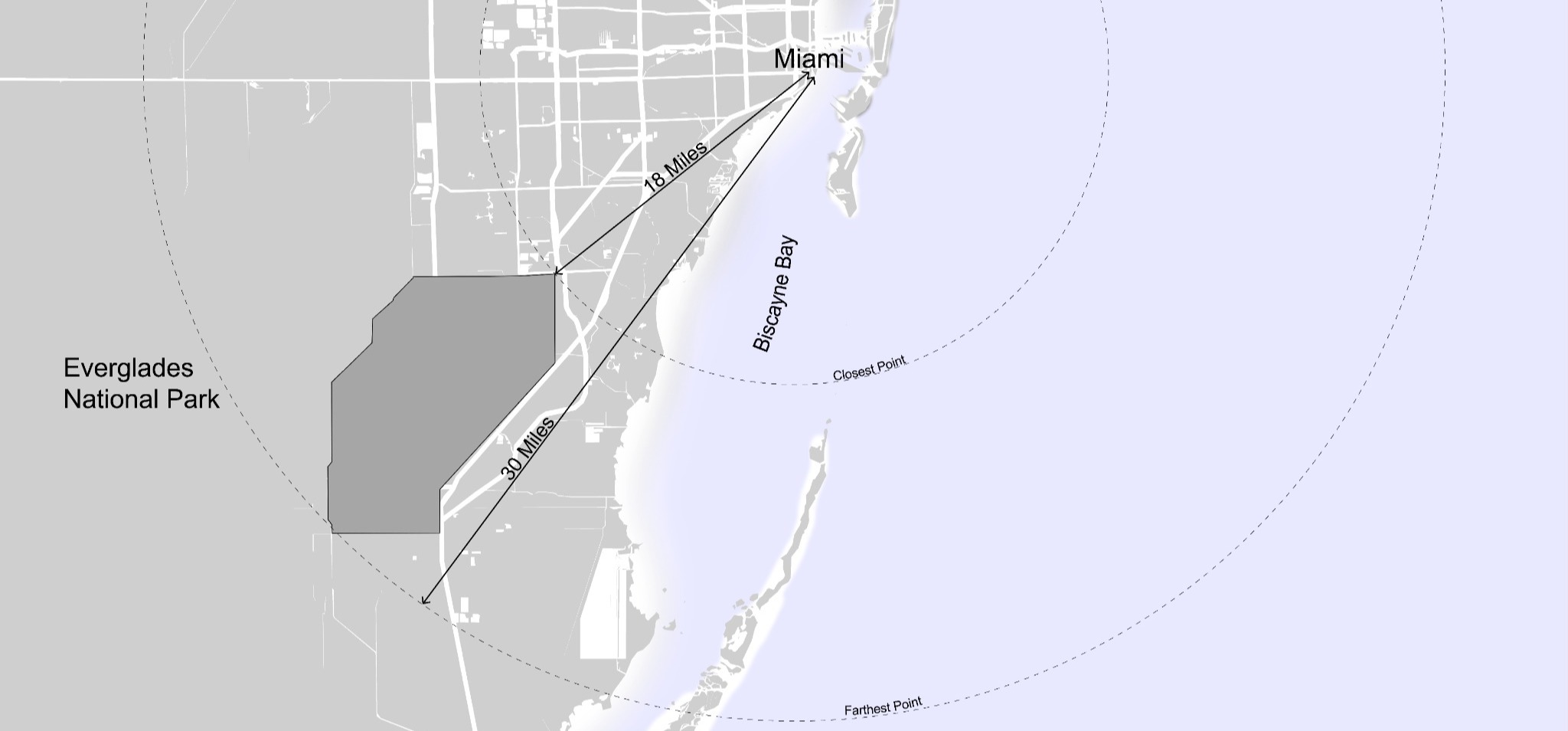
Location
Analysis
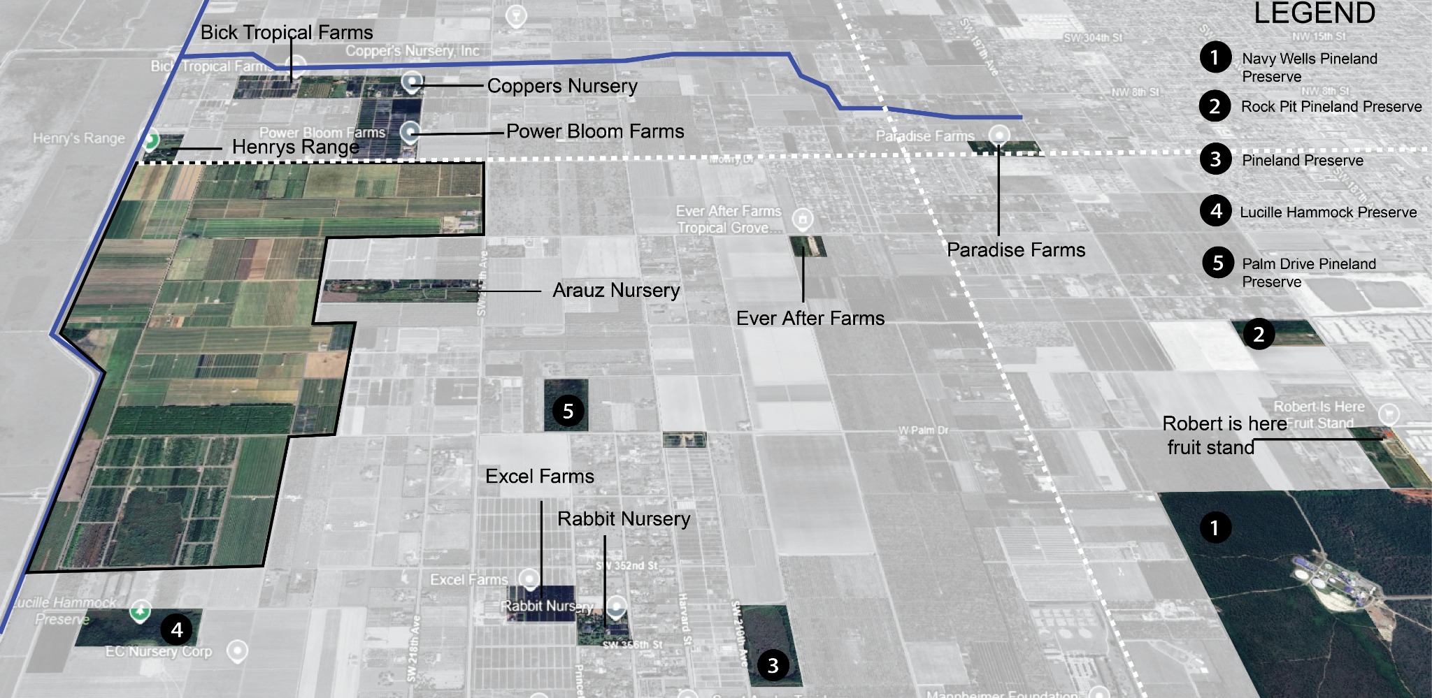
Throughout the research, the redland was separated into three distinct. This division facilitated a thorough examination of the current site conditions, including existing structures, site characteristics, and construction methods.
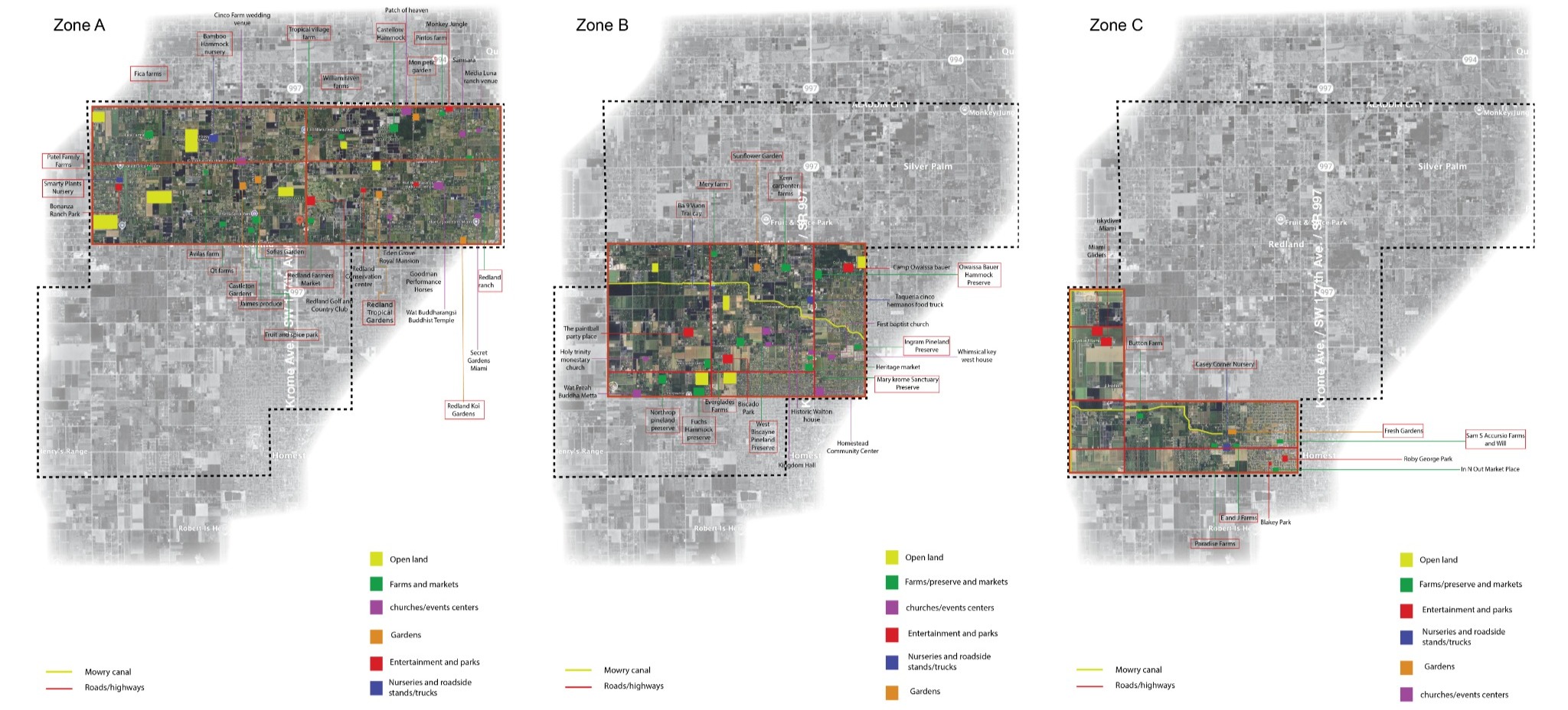
Zone A
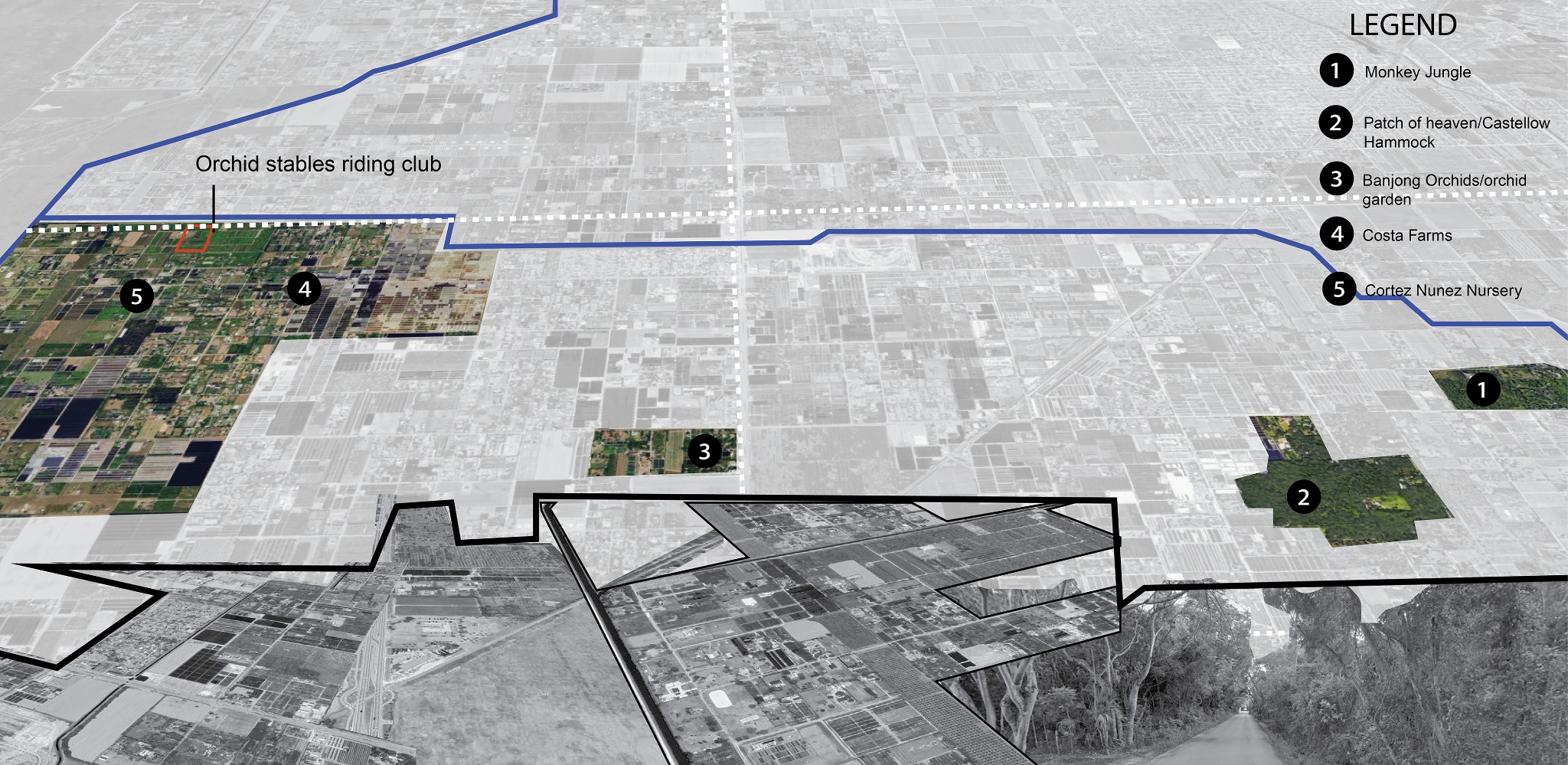
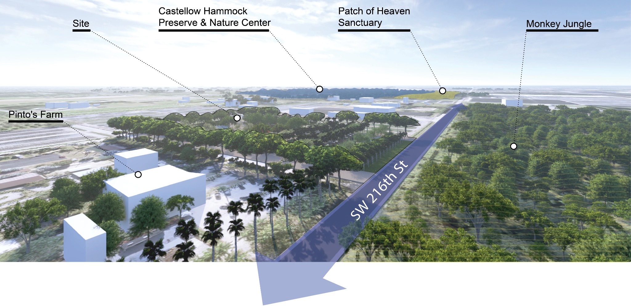
The northern tip has attractions like Castellow Hammock Reserve, Patch of Heaven, and Monkey Jungle. It is a key entry point, with the Princeton Canal running west to east and Krome Avenue running north to south.
Zone B
The District’s Fruit & Spice Park, a botanical garden, houses hundreds of tropical fruits, herbs, and spices. It’s the only park of its kind in the U.S.and offers guided tram tours and fruit sampling.
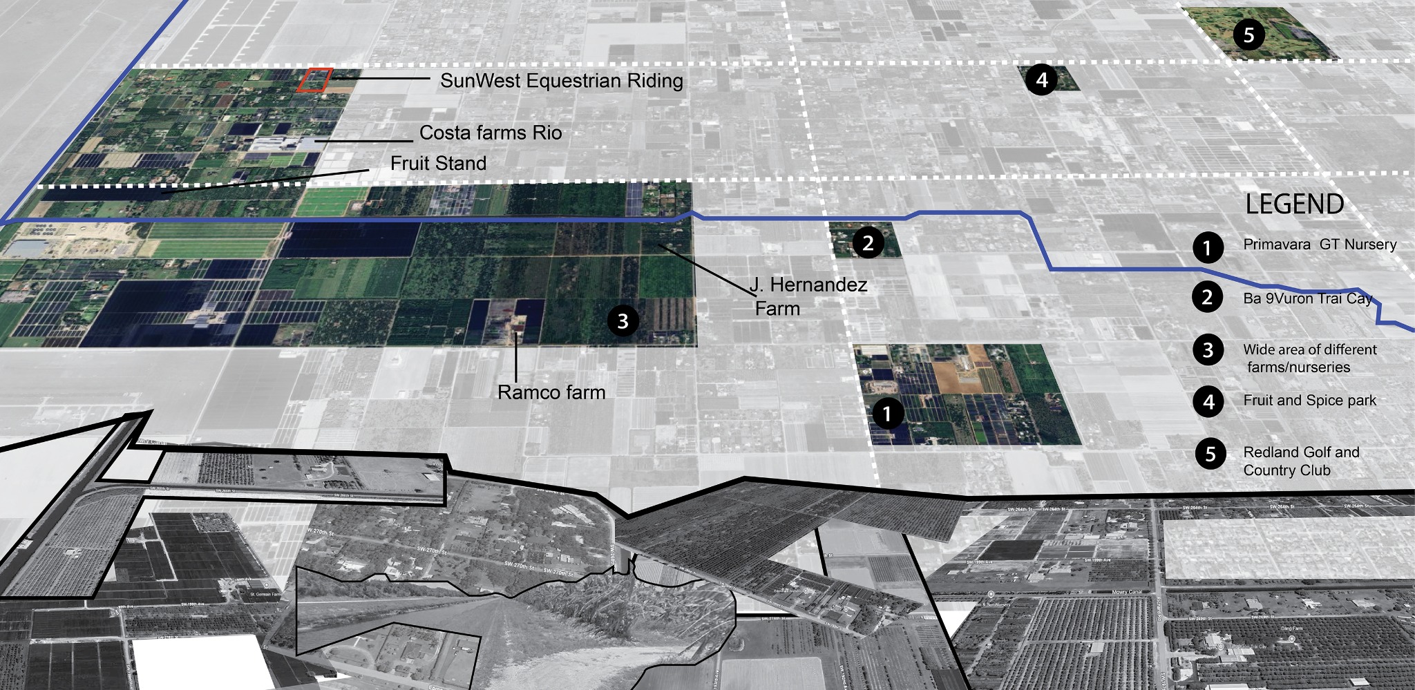
Zone C
In addition to hosting a diverse range of farms and nurseries, the southernmost area of Redland serves as a gateway to one of Florida’s famous landmarks, the Everglades National Park.
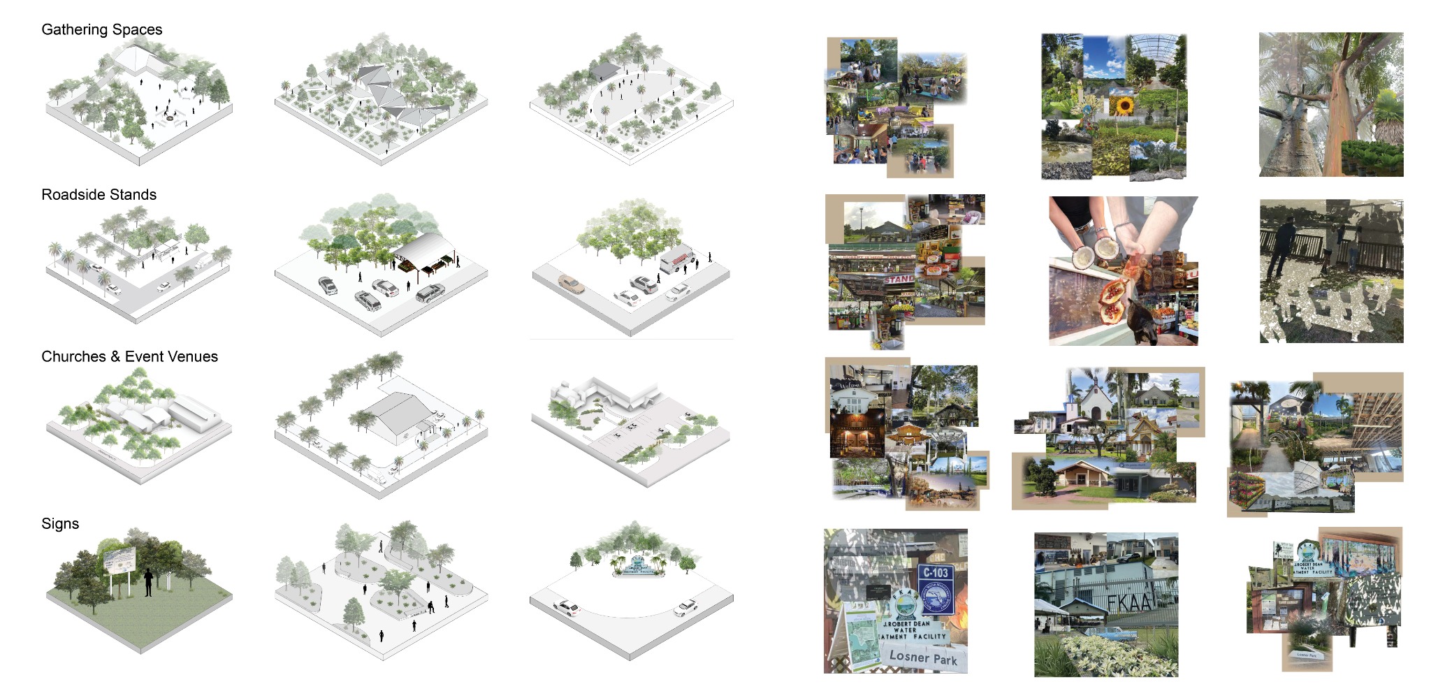
Case Study
After several site visits to evaluate features, values, and landscape, collages and drawings were made to show findings, highlighting gathering spaces, churches, event venues, roadside stands, and signage.
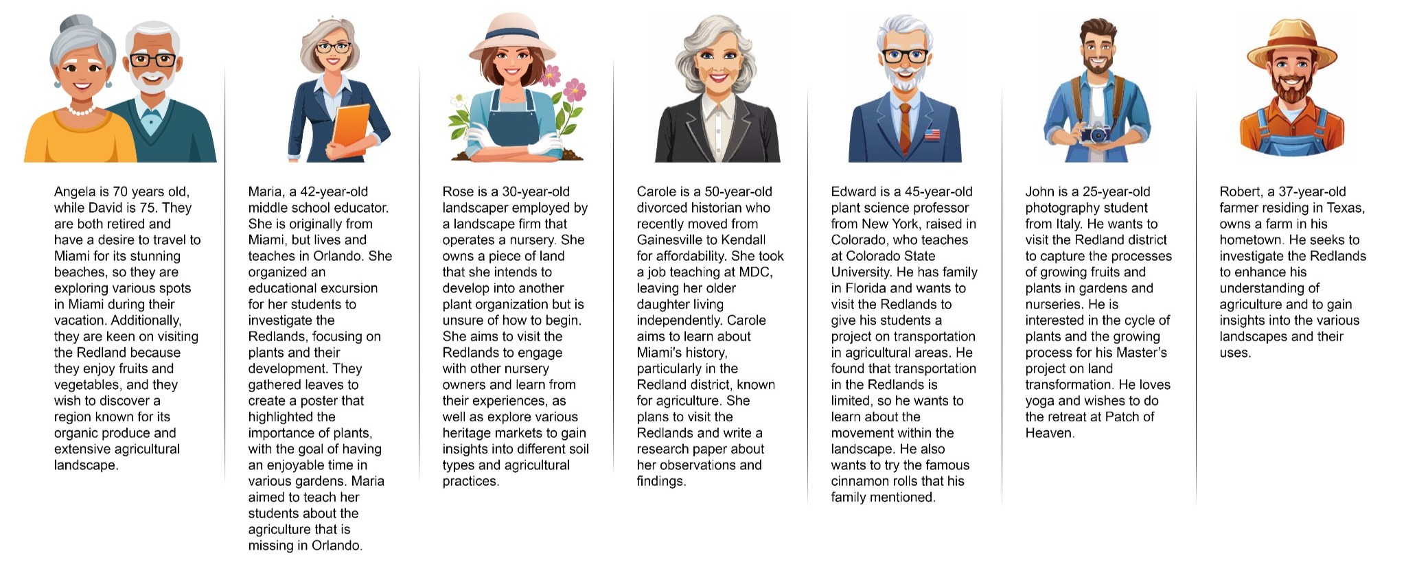
User Profiles
Understanding expected visitors is key for the local economy, along with celebrating the area’s uniqueness through resident insights. Profiles were created to capture the experiences different design elements aim to evoke.
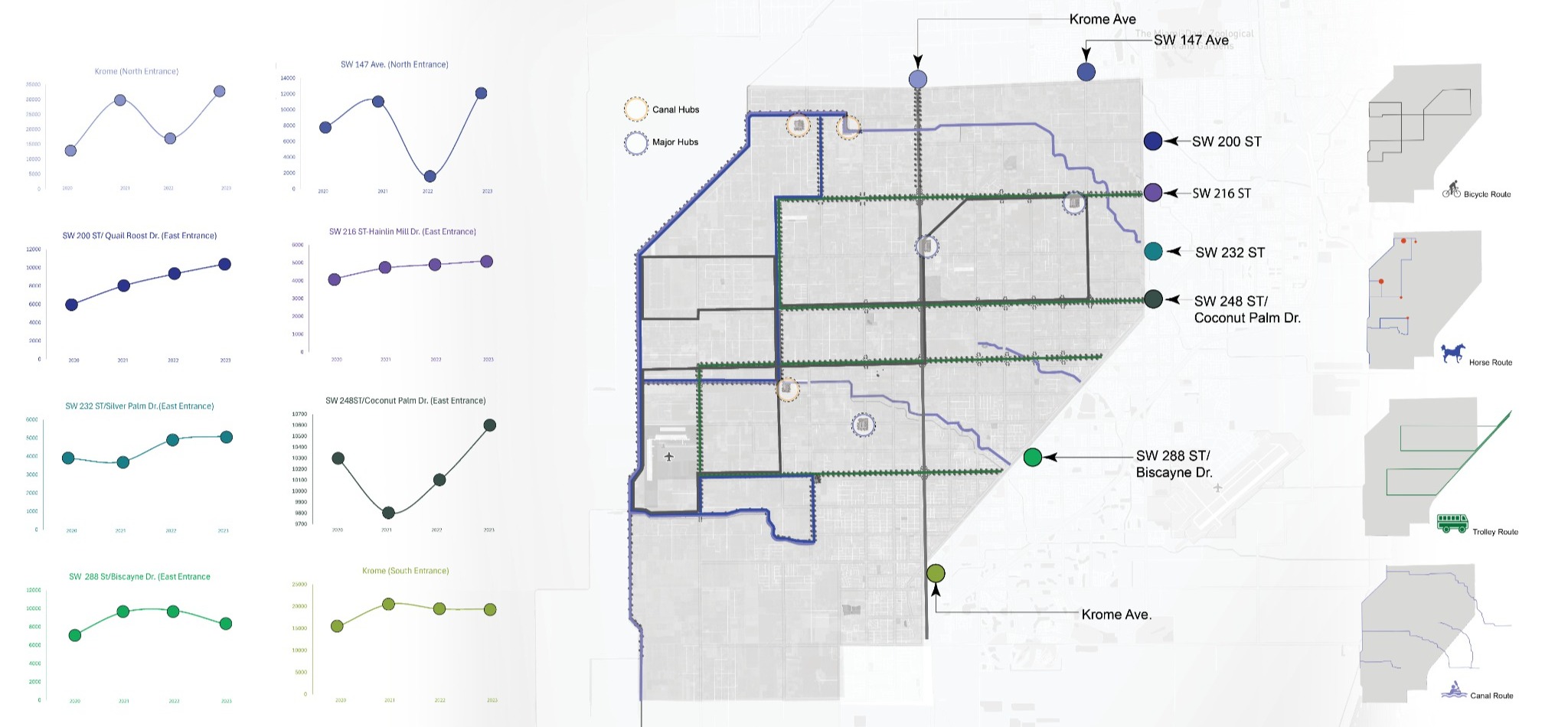
Traffic Analysis & Proposed Routes
The evaluation of Redland entry points plans to manage more vehicles with visitor parking, trolleys, bicycles, horseback riding, and canal exploration.
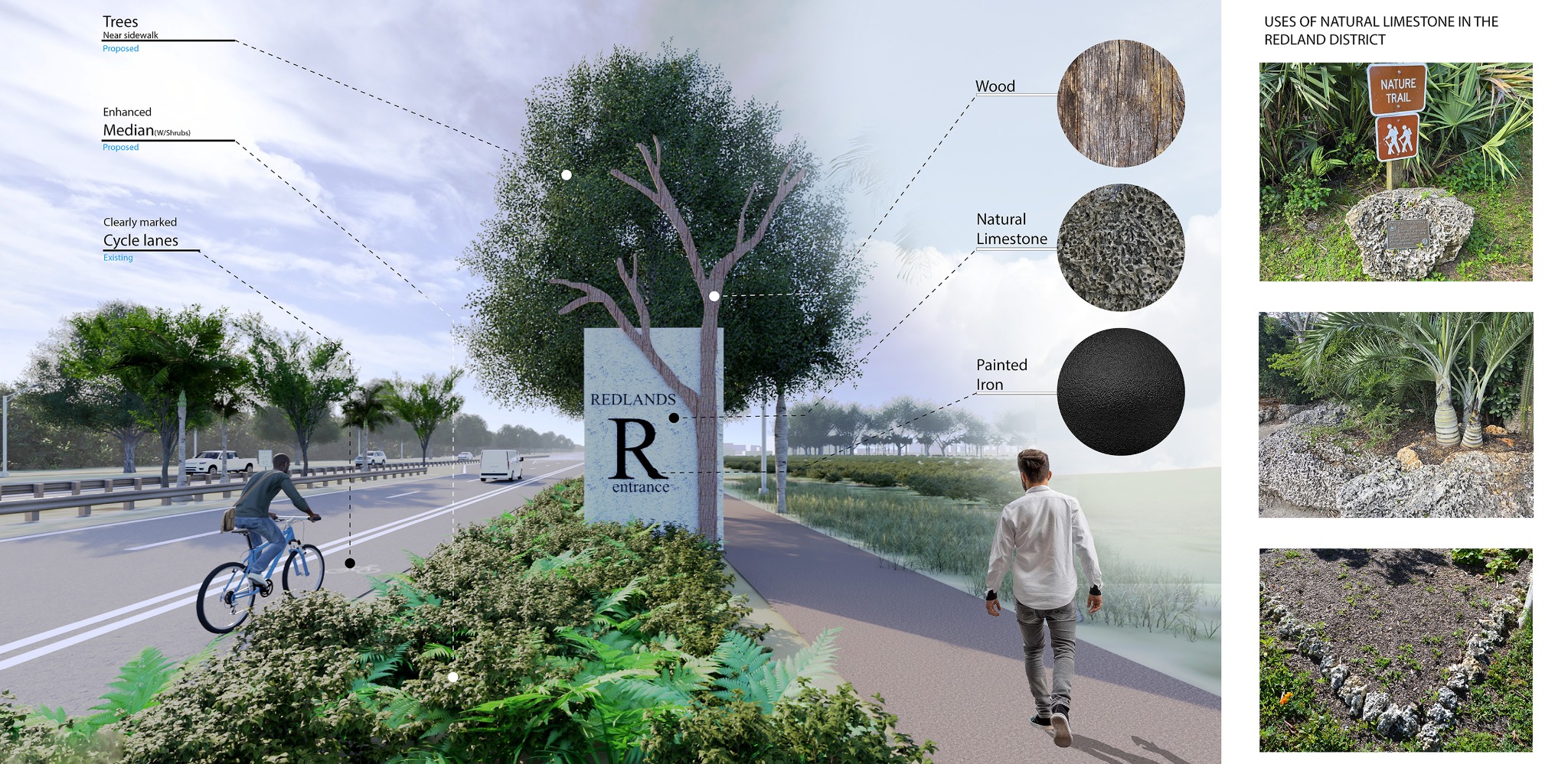
District Entrances
An analysis indicates unclear entry points into the district. Proposed enhancements include planting native trees and installing signage that reflects local materials and modern elements.
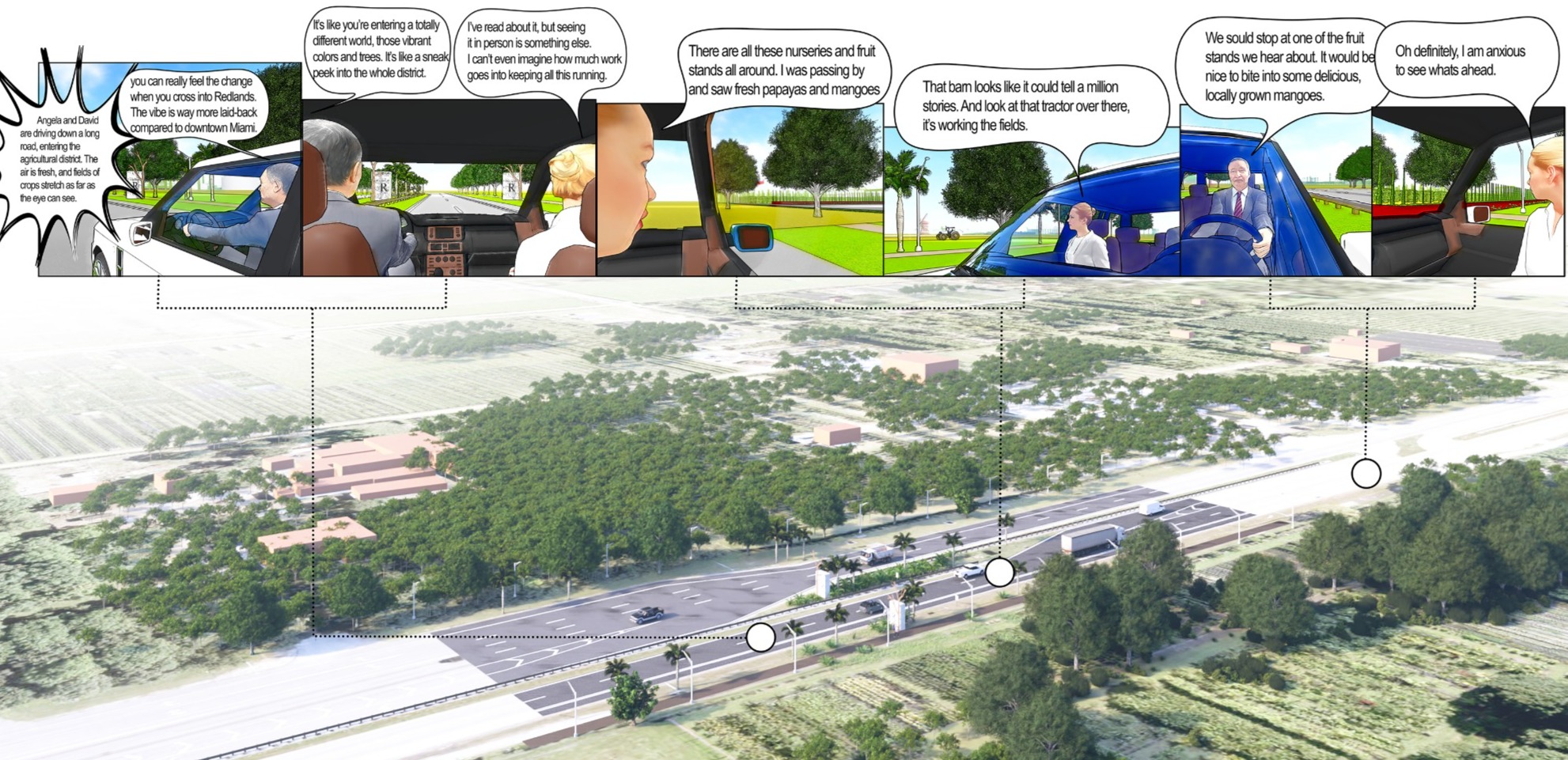
District Entrance Experience Map
Using the developed profiles, a situation was created through conversation to show possible feelings of guests as they arrive and see the farm fields and nurseries.
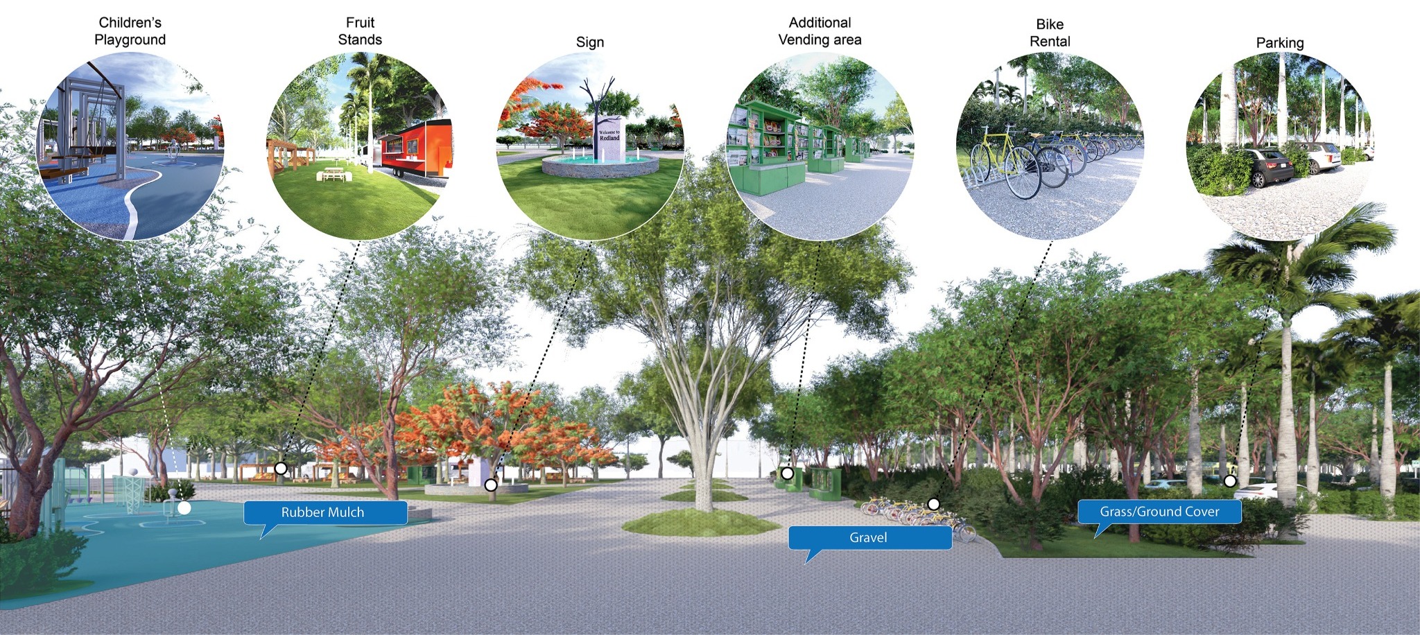
Multiple sites chosen for a hub will facilitate visitor parking and transportation to redlands via trolley or bicycle. It will feature native plants and surfaces for locals to sell homegrown produce.

Site Contexts
The hubs feature clear signs, designated parking, a bike rental area, a children’s playground, and spaces for local vendors, matching the Redlands district’s ground texture.
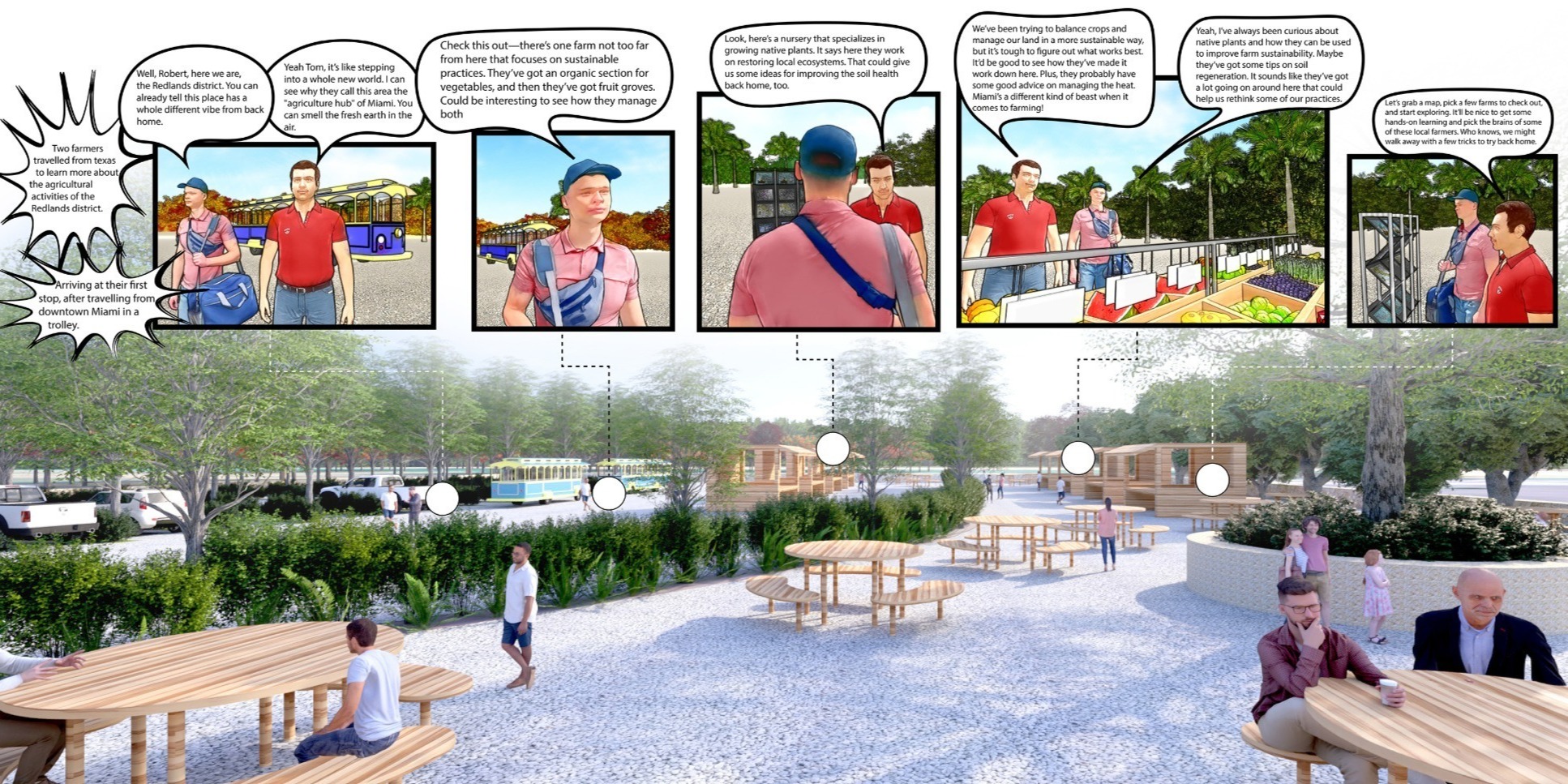
Hub Experience Map
The conversation shows Robert and Tom’s first visit to the hub. They relax, eat, look at maps on signs, or grab a printed map of activities in redland.
The canal hubs serve as resting spots for horses carrying sightseers. They also offer gathering spaces for locals for activities like fishing, picnicking, and using the outdoor gym.

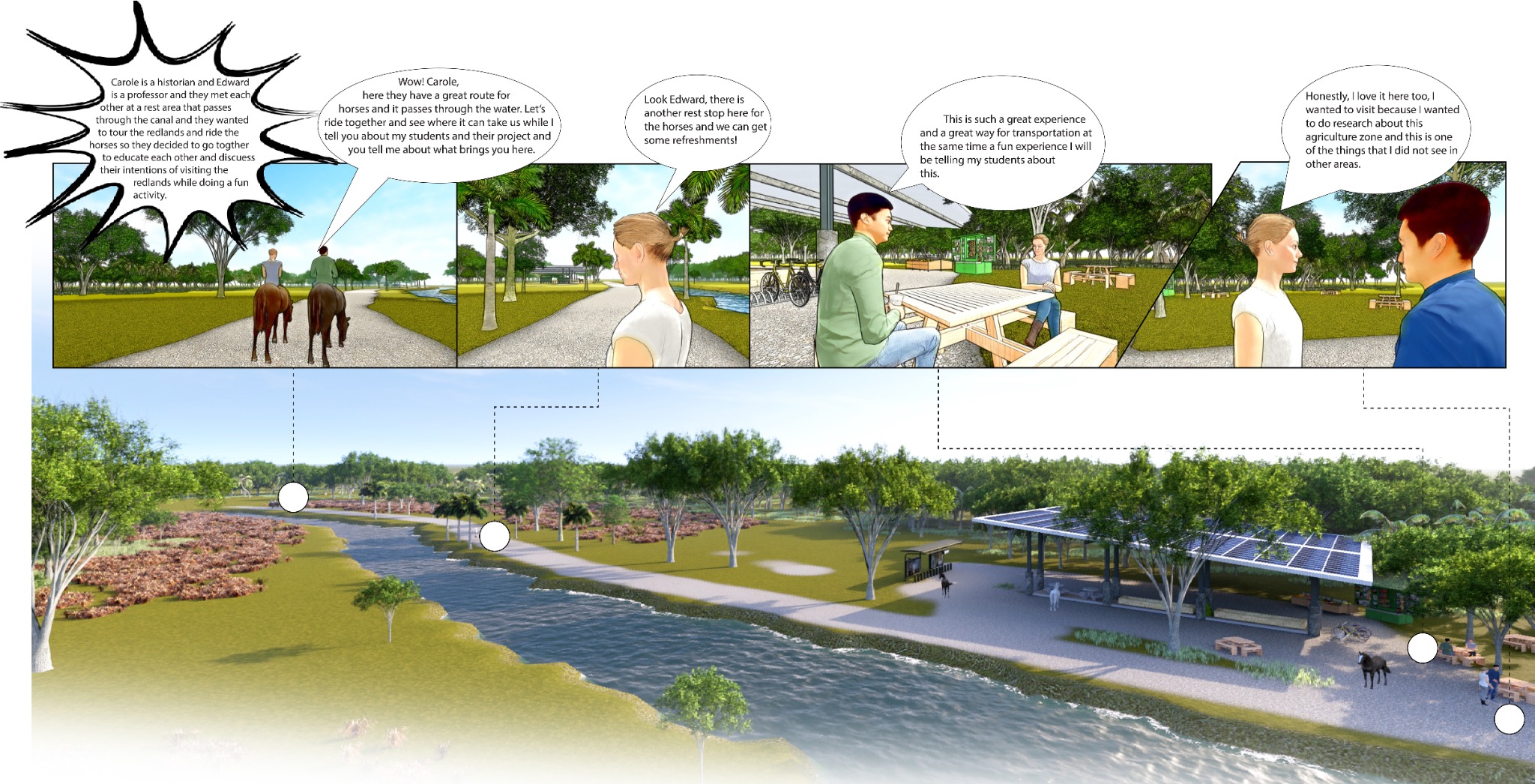
Horseback Riding Experience Map
Carole and Edward met at a rest area, both interested in Redlands and horseback riding. They decided to work together to share knowledge and discuss their plans while having fun.